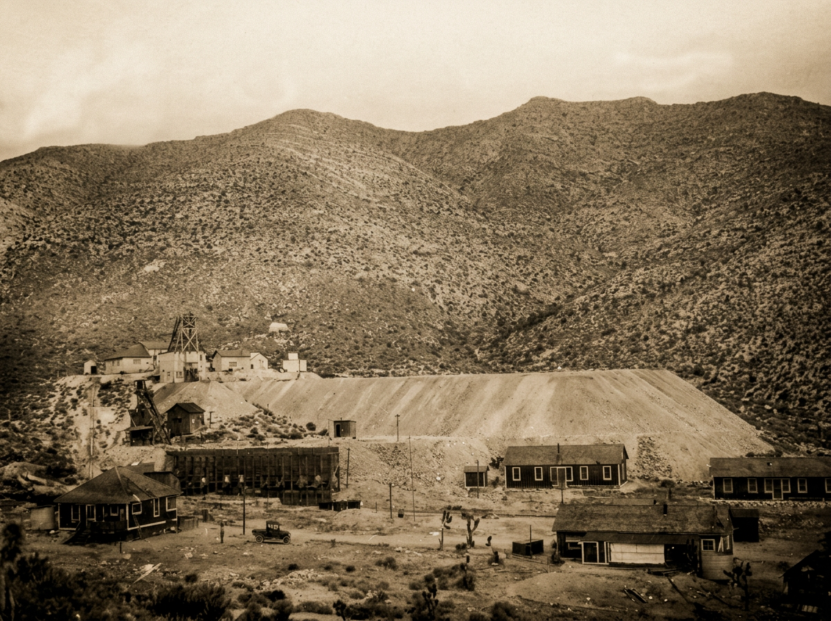
Drive 40 minutes south of the Las Vegas Strip, turn west at Jean, and you roll into one of the richest pieces of mining history in Nevada. The hills around Goodsprings are the Yellow Pine Mining District, and Adrenaline Mountain sits right inside it. Every off-road tour on our private trails passes old shafts, tailings piles and ridgelines that miners worked more than a century ago.
Where the name comes from
Long before the mines, a cattleman named Joseph Good found a spring here around 1868. "Good's spring" became Goodsprings. Miners from the nearby Ivanpah district explored the mountains, and the Yellow Pine Mining District was organized in the early 1870s. The name likely came from the pines in the Spring Mountains and was in use as early as 1872. The mining company was named after the district, not the other way around (Queho Posse, E Clampus Vitus).
Officially, Yellow Pine is part of the larger Goodsprings Mining District. That district traces back to 1856, when Mormon miners began working lead at Potosi, possibly the oldest underground mine in Nevada (Nevada State Historic Preservation Office, Marker No. 102). Gold was found in 1882, and when the Yellow Pine Mining Company bought up most of the claims in 1901, locals started calling the whole area the Yellow Pine Mining District (Ken's Photo Gallery).
The Yellow Pine Mine
The Yellow Pine Mine sits about 3.6 miles west-northwest of Goodsprings, east of Shenandoah Peak. It was discovered in 1892 and ran mostly from 1906 to 1928 (Mindat). The company held 12 claims covering a ravine locals called Porphyry Gulch. The first ore it shipped, in 1906, was just 18 tons of copper. What made the mine famous was something else: zinc carbonate (Ken's Photo Gallery).
Geologists describe the ore as a "polymetallic replacement deposit" hosted in the Monte Cristo (Yellow Pine) Limestone. In plain terms, mineral-rich fluids ate into the limestone and left behind pipes and layers of lead, zinc, silver and copper ore. Mindat lists dozens of minerals from the mine and its neighbors, including galena, cerussite, hemimorphite and hydrozincite (Mindat).
The mines next door
Ken's 2013 trip through the district, riding a side-by-side with his hiking partner Harvey, turned up the remains of at least five major mines and dozens of smaller shafts. A few of the stories he documented (Ken's Photo Gallery):
- Prairie Flower Mine: Sold in 1908 for $6,000. The buyers struck lead within weeks and flipped it for $12,000. In 1909 and 1910 it shipped 1,314 tons of lead and zinc ore. It was later connected underground to the Yellow Pine, and the two now count as one mine.
- Alice Mine: Located in 1892, but full production waited until 1909. Its main shaft runs about 680 feet on a slope just over 21 degrees. It produced around 3,000 tons, mostly zinc, worth an estimated $100,000.
- Middlesex Mine: Half a mile southeast of the Yellow Pine in Horseshoe Gulch. Located in 1901, with tunnels of 100 and 400 feet. Its total output is still unknown.
- Green Copper Mine: A 125-foot tunnel that produced only two carloads, about 75 tons of copper ore.
A railroad up the mountain
Hauling ore by wagon cost a fortune. Company founder J. F. Kent bought rails from a closed mine near Searchlight, and in June 1911 the narrow-gauge Yellow Pine railroad opened between Jean and Goodsprings. Another 4.5 miles soon reached the mines. Grades hit 4 to 5% between Jean and town and up to 12% near the mines. The first gasoline locomotive was wrecked three times in a few months, so the company bought a Shay locomotive in 1912 (PacificNG).
The railroad paid off. Goodsprings hit its peak in 1916 with about 800 residents. The district, which has the greatest variety of minerals in Nevada, produced about $25 million, mainly lead and zinc, plus gold, silver, copper, vanadium, platinum and even uranium (Nevada SHPO). The original mill in Goodsprings burned on September 19, 1924 (PacificNG).
Seeing the district today
Most of the district is now quiet desert. Old shafts are dangerous, so never enter one. Even Ken, an experienced explorer, only photographed the openings (Ken's Photo Gallery).
The safest way to see it up close is on our 400-acre private park:
- Off-road tours: Drive a Can-Am Maverick UTV or Jeep Wrangler past 1920s-era mine sites and stop on top of a historic mine tailings plateau for views across the valley.
- Outdoor shooting: Fire machine guns against the same Mojave Desert hills the miners worked.
- Extreme weddings: Say "I do" on a 20,000-square-foot plateau on the historic Yellow Pine Mine.
- Getting here: We're about 40 minutes from the Strip, near Jean and just outside Goodsprings, with a free Strip hotel shuttle.
After your adventure, stop in Goodsprings for a look at the town that the Yellow Pine built.
Sources
- Ken's Photo Gallery, "The Yellow Pine Mines (Summary Page)" and "Goodsprings Mining District"
- Mindat, "Yellow Pine Mine, Goodsprings, Clark County, Nevada"
- Nevada State Historic Preservation Office, "Goodsprings Mining District 1856-1957, Historical Marker No. 102"
- PacificNG, "Yellow Pine Mining Company"
- Queho Posse, E Clampus Vitus, "The Arrowhead Trail Highway and Yellow Pine Mining Railroad"
- Christina A. Miller, "Goodsprings: A historical archaeological review of the Yellow Pine Mining District," UNLV thesis, 1991
